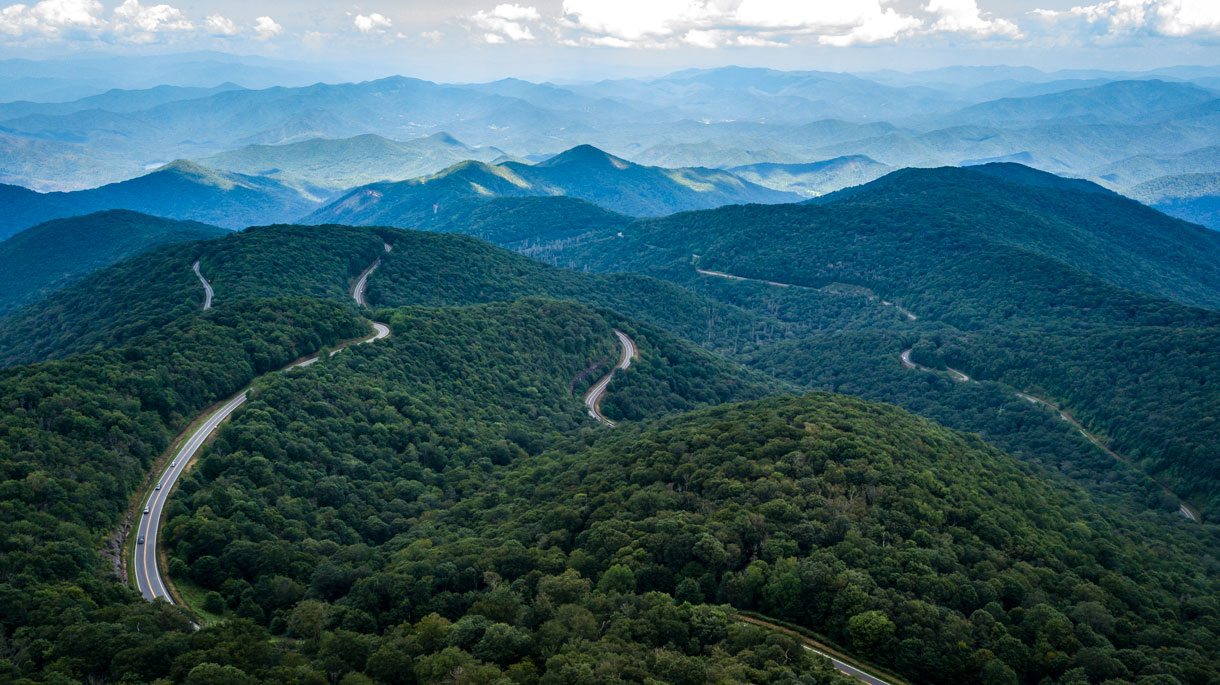
The Cherohala Skyway was completed in the fall of 1996 after planning and construction for some thirty-four years. It was North Carolina’s most expensive scenic highway carrying a price tag of $100,000,000. It winds up and over 5,400 foot mountains for 18 miles in North Carolina and descends another 23 miles into the deeply forested back country of Tennessee. The road crosses through the Cherokee and Nantahala National Forests thus the name “Chero…hala”. The Skyway is becoming well known in motorcycling and sports car circles for it’s long, sweeping corners, scenic views, cool summer breezes, fall colors, and winter vistas.This road enthusiast’s dream connects Robbinsville, North Carolina with Tellico Plains, Tennessee. It can be desolate at night and dangerous in the winter months. There are no facilities other than a couple of restrooms for the entire 41 miles so make sure you have enough gas to make the crossing. There is little evidence of civilization from views that rival or surpass any from the Blue Ridge Parkway.
It can be cold and cloudy riding the mountain ridges, so make sure you dress properly, even in the summer months. We have been caught in pea soup fog, thick clouds, and bone chilling temperatures even in July. The mile-high ride is always a new and unforgettable experience.
Beginning at Santeetlah Gap on the North Carolina side (at elevation 2660 feet), attractions include the nearby Joyce Kilmer Memorial Forest, a number of scenic overlooks with views of the Santeetlah river basin and distant mountains, Huckleberry Trail, Hooper Bald picnic area with views of other balds, Santeetlah picnic area, the Benton McKaye Trail, and Stratton Ridge picnic area. At the North Carolina/Tennessee State Line the old wagon train road (FS 81 in NC/N. River Road in TN) crosses the Cherohala. This 30 mile gravel Forest Service Road offers extensive backwoods settings and rustic camping spots, great for dual sport and Jeep explorations.
At the state line the descent starts into the Tellico River basin. There are several spectacular scenic vistas on the Tennessee side. Brushy Ridge and Turkey Creek overlooks are good picnic spots. You’ll pass the turn-off for Indian Boundary Waters which offers great camping and back road dual sport/jeep explorations.
A detour to Bald River Falls on paved Forest Service Road 210 is well worth the short trip. Water cascades over 100 feet onto the rocks below – all which can be seen from the comfort of your motorcycle/car.
The Tellico River, at the lower elevations on the Tennessee side, is famous for it’s trout fishing, and when the water is up, can be quite a challenge for canoers and kayakers. The river leads you to the sleepy town of Tellico Plains where you can fill your tank and feed your belly. We recommend the Tellico Kats Deli where you can enjoy homemade sandwiches on a deck overlooking the river.

